Luxembourg meets the World
Golden Circle in Iceland
The Golden Circle is perhaps the most visited tour to do in the Southwest of Iceland. It’s basically a tour of 230 km from Reykjavik and back. There are a few other points, which you can include to your Golden Circle Tour, e.g. Kerið volcano crater, Hveragerði greenhouse village, Skálholt church, and the Nesjavellir or Hellisheidarvirkjun geothermal power plant or even snorkel between two tectonically plates.

The Golden Circle consists of three main attractions in the Southwest of Iceland:
- Þingvellir National Park
- Geysir Geothermal Area
- Gullfoss
You can easily add Reykjavik City and the Blue Lagoon to complete the most popular sights in Iceland.
Þingvellir National Park
The Þingvellir National Park is probably a unique place in Iceland and therefore also the most time taking stop. It is better to visit the National Park first. It’s about 45 min from Reykjavik and really easy to reach by car. When you approach the Þingvellir National Park, there are several parking areas where you can park your car. We stopped really at the beginning of the Park and we did the whole park by foot.
The Þingvellir National Park is a natural wonder of the world. It is part of the Atlantic Ocean ridge that runs through Iceland and also the boundary between the North American and Eurasian tectonic plates.
Þingvellir is also the place where the first Parliament, called Alþing, was established. The annual parliament was held at this place from 930 to its last session in 1798.
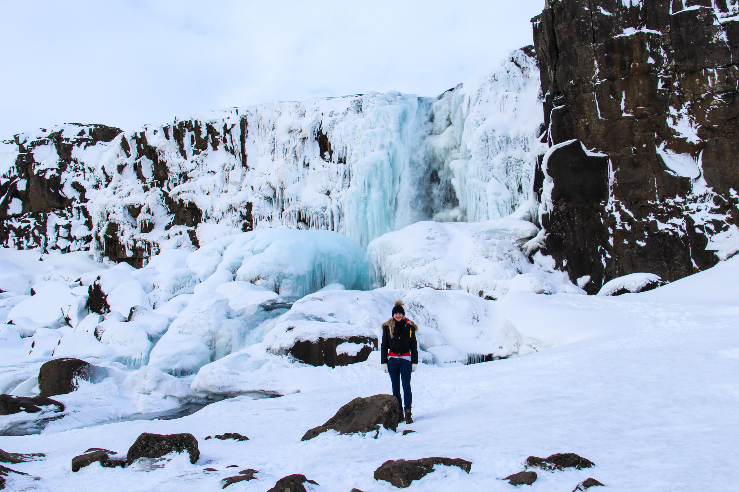
 The first stop was Öxarárfoss, a 13 meters high and 6 meters average wide waterfall in Þingvellir National Park. This waterfal is feed by the river Öxará. It is a human-made waterfall that sits on the edge of the boundary between the North American and Eurasian tectonic plates. Öxarárfoss is also known because of the series Game of Thrones.
As we visited Iceland in winter, the waterfall was almost completely frozen. In summer during peak season, Öxarárfoss is very crowded because it is one of the main attractions in Þingvellir National Park.
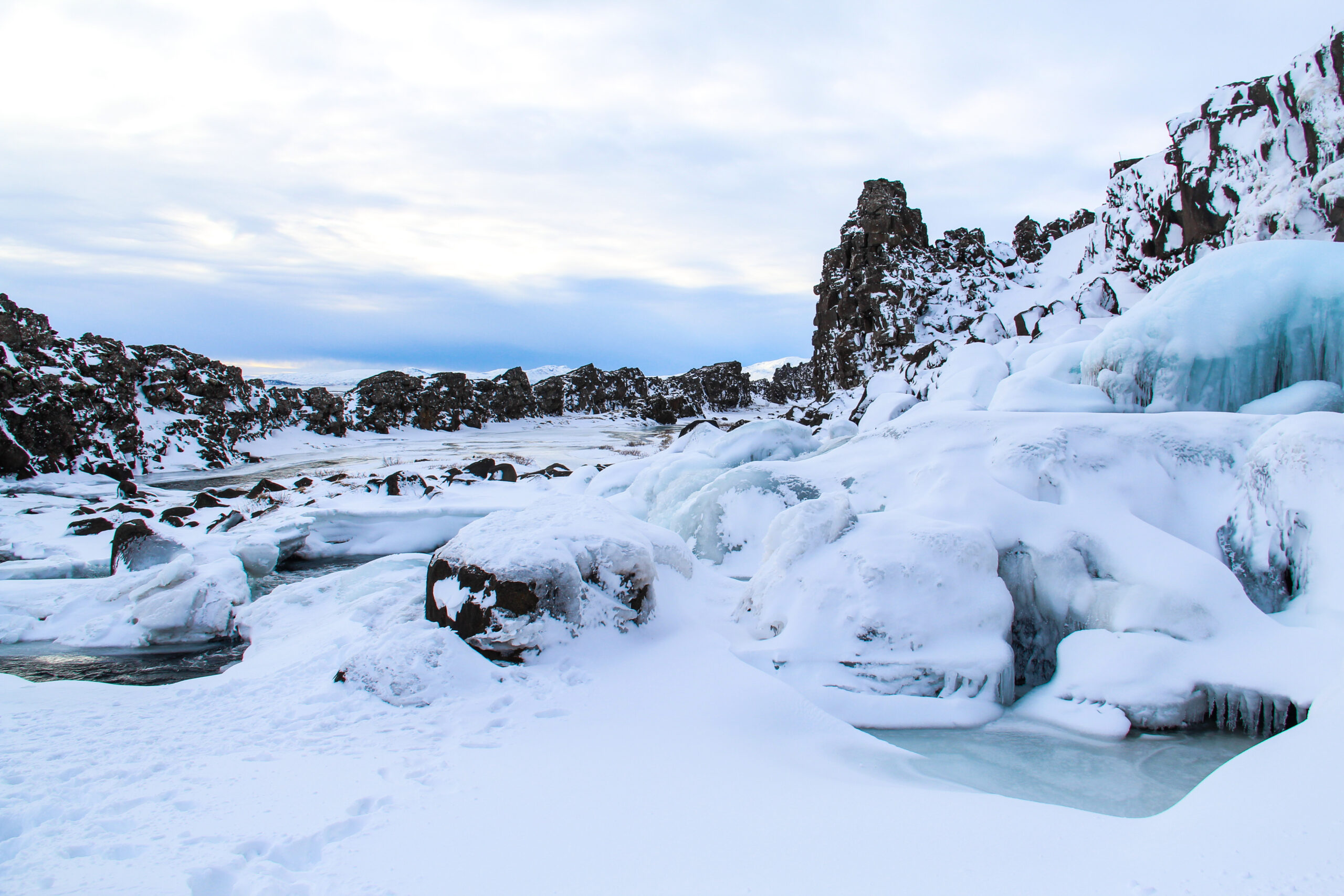
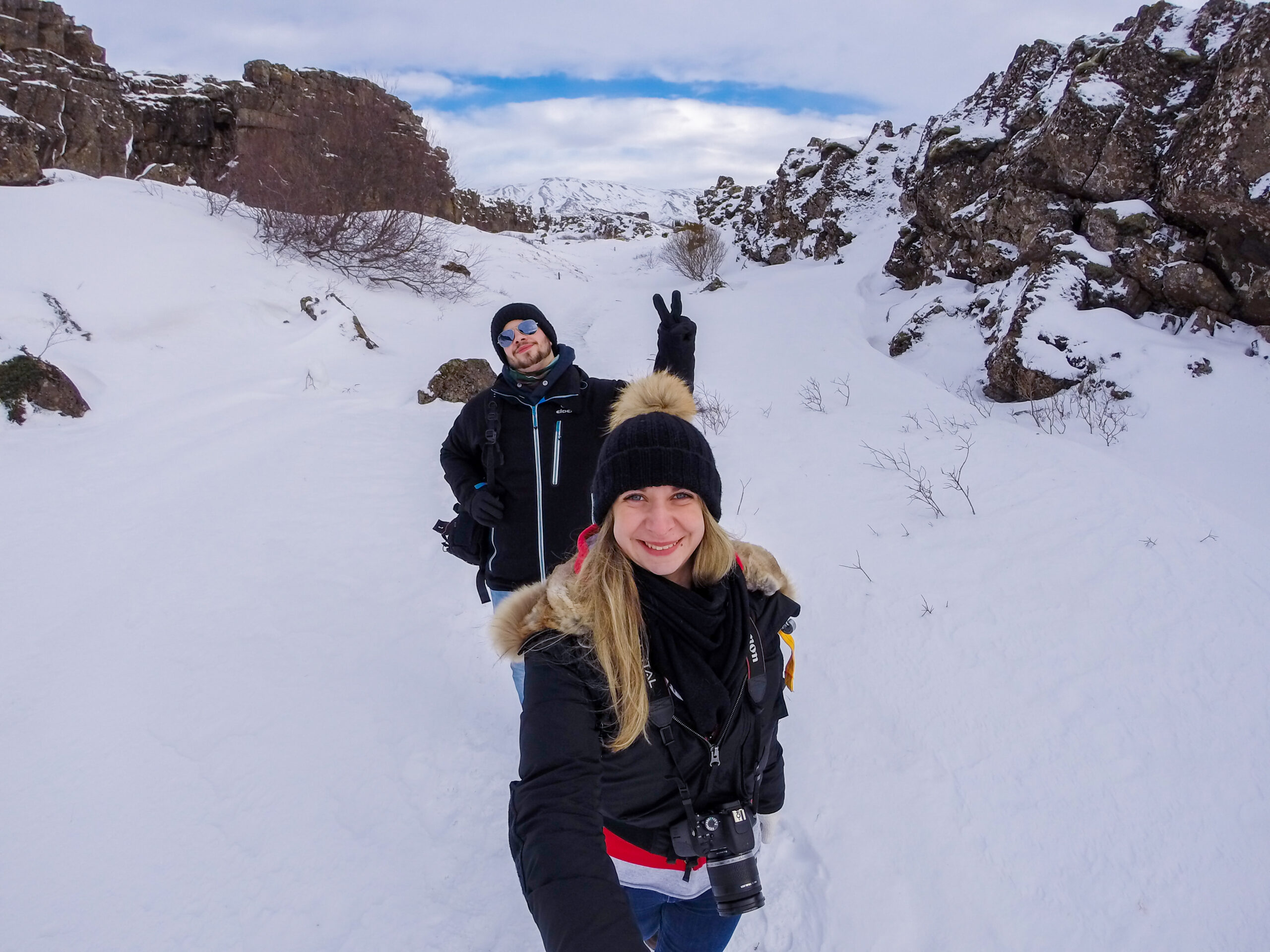
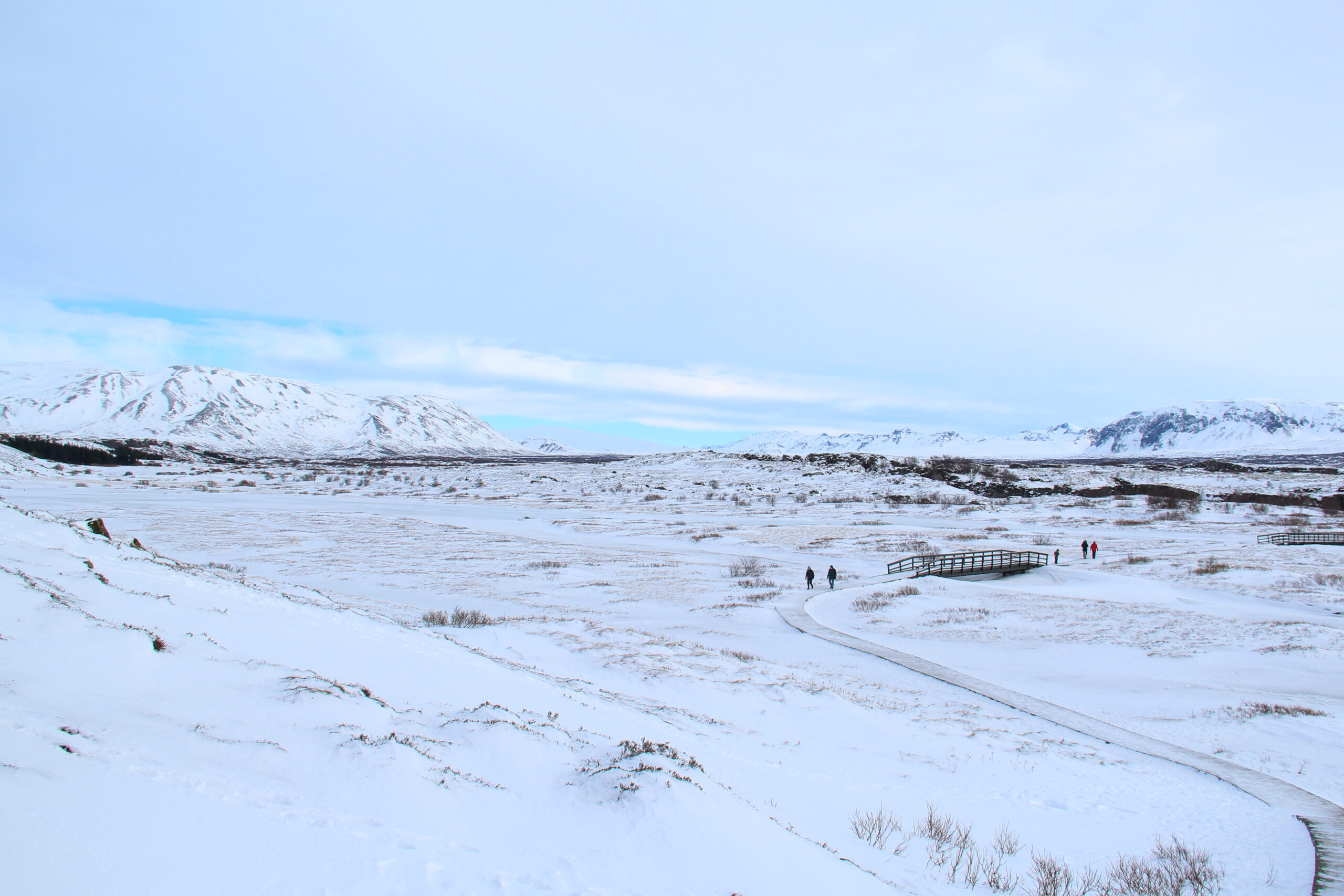
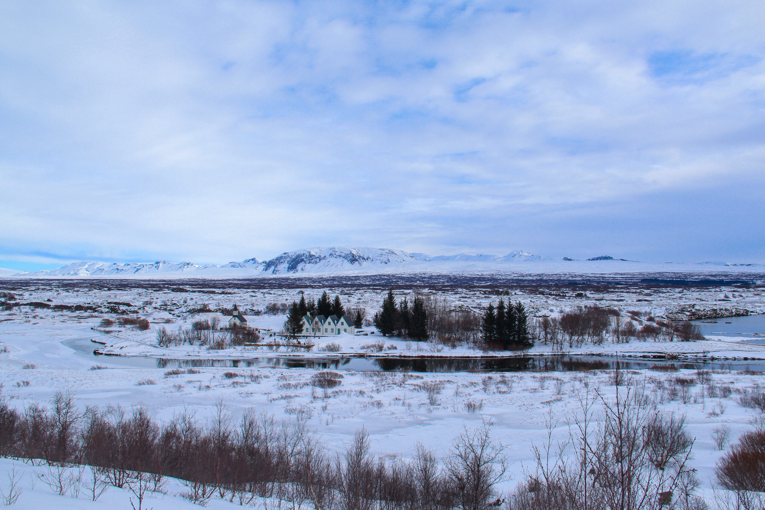
After continuing the hike trough the National Park, you will reached a viewpoint. From there you will have a view over the whole stunning park with the Thingvallavatn lake. The National Park itself as a size of 240 km2. In winter, everything is covered with snow and ice and you have to pay attention not to fall because of the ice.
Now you have two options to continue. The first is to descend into the center of the Park, and the other is to continue the path. We opt for the first option and descend into the Park.
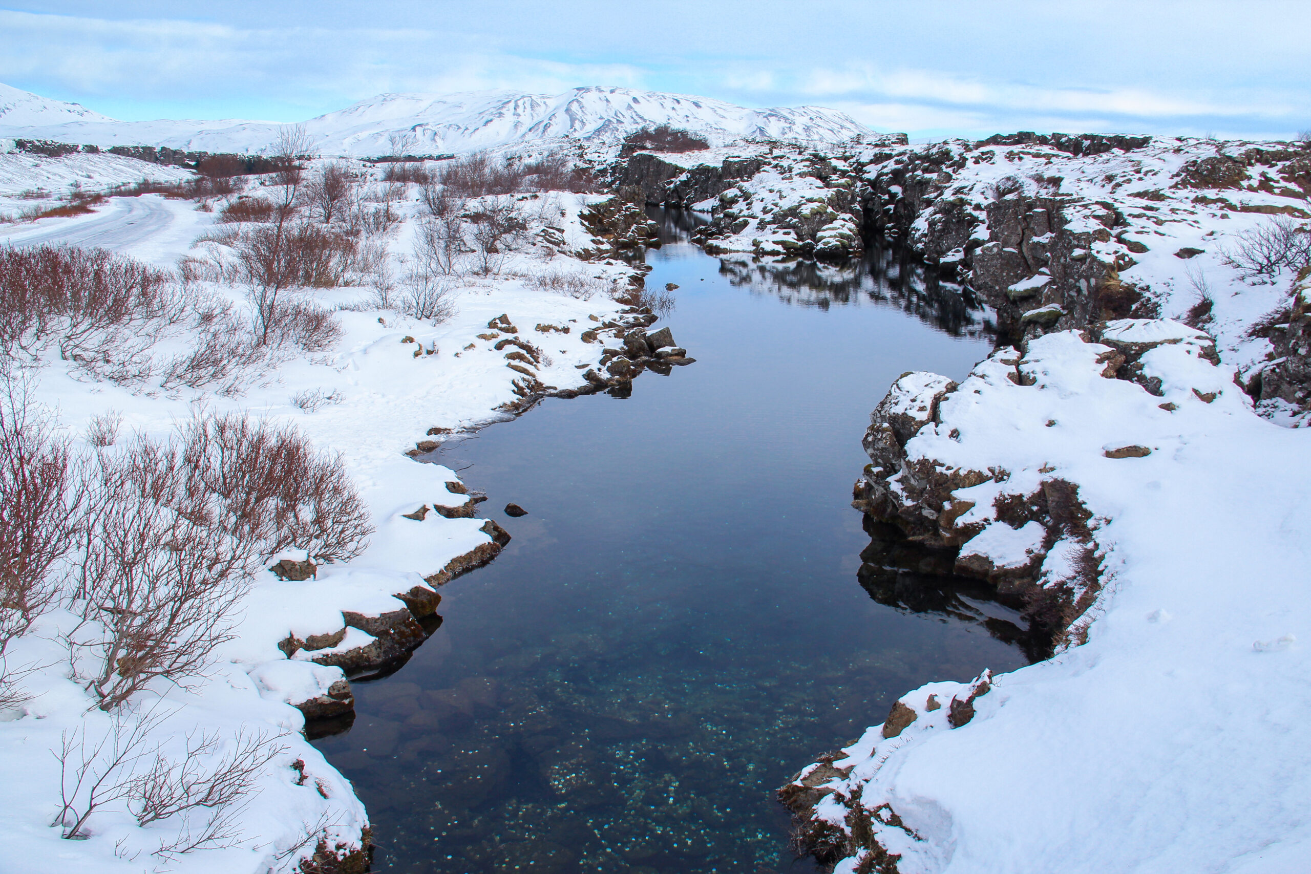
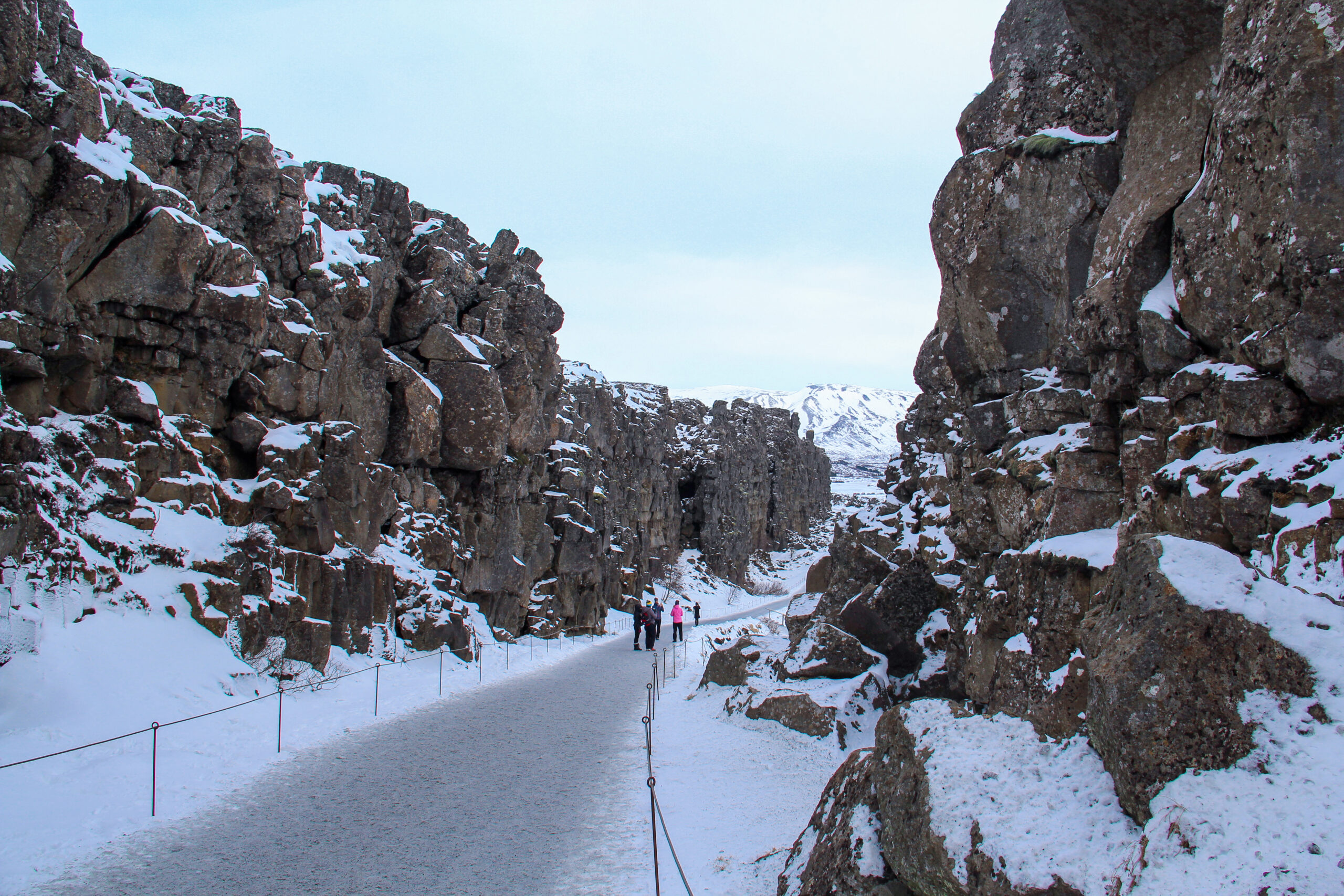
After hiking for a few minutes and crossing some bridges, you will reach Peningagjá. This is the Mid-Atlantic Ridge. On the one hand is the Eurasian tectonic plate and on the other hand is the North American plate. It is the only place, where you can see the continental drift above the sea. This river is also called Money fault. It is believed that throwing a coin into Peningagjá will bring you luck and fortune. Since 1907 people throw coins into the river but now the authorities have decided against it to preserve nature.
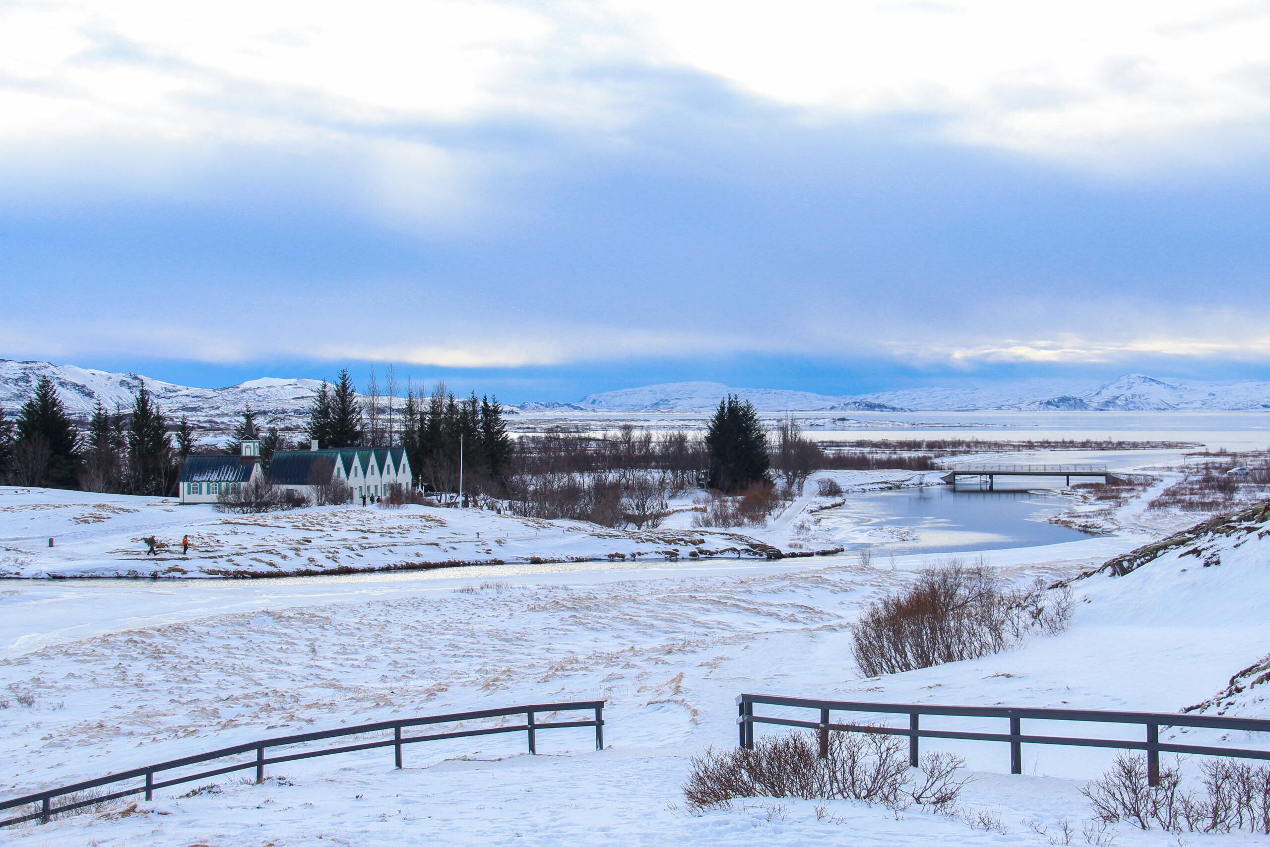
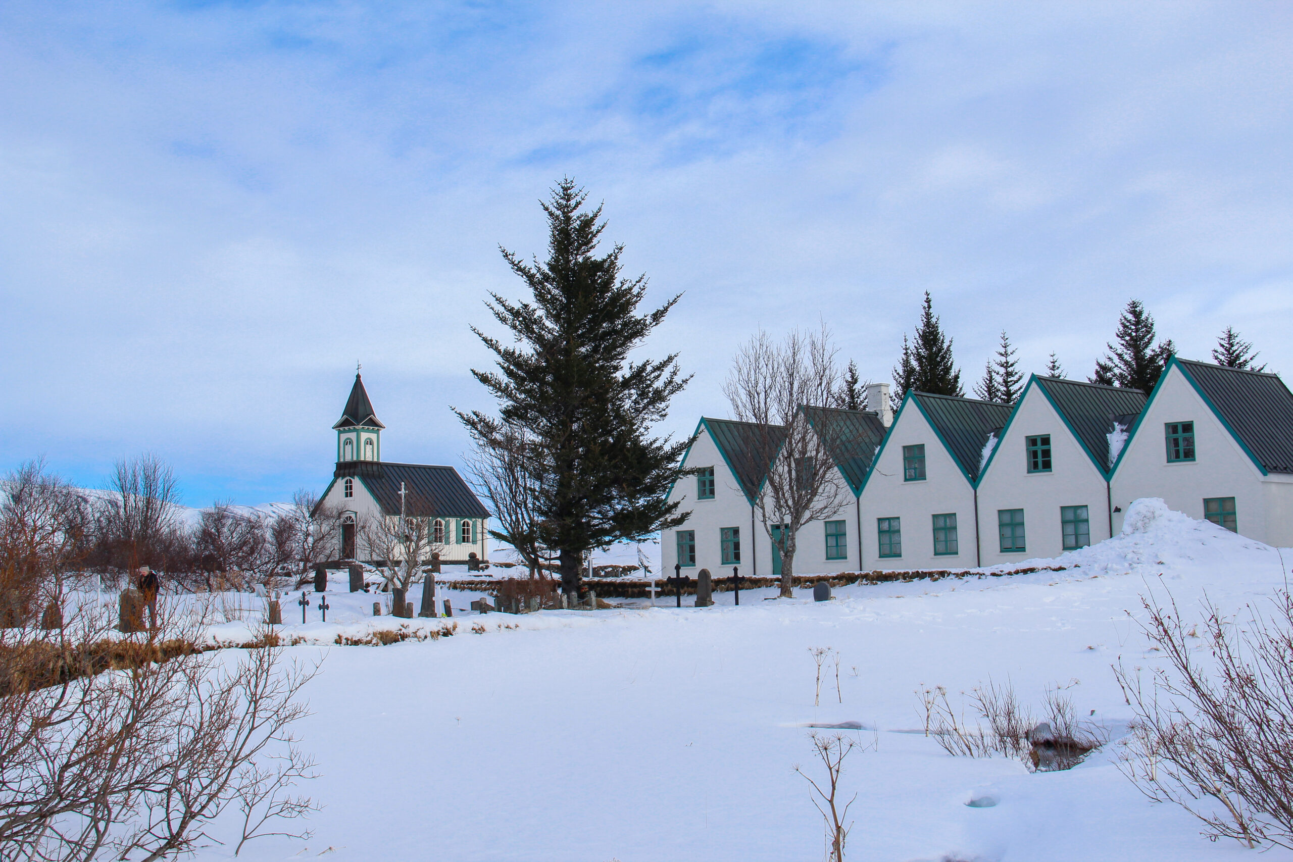
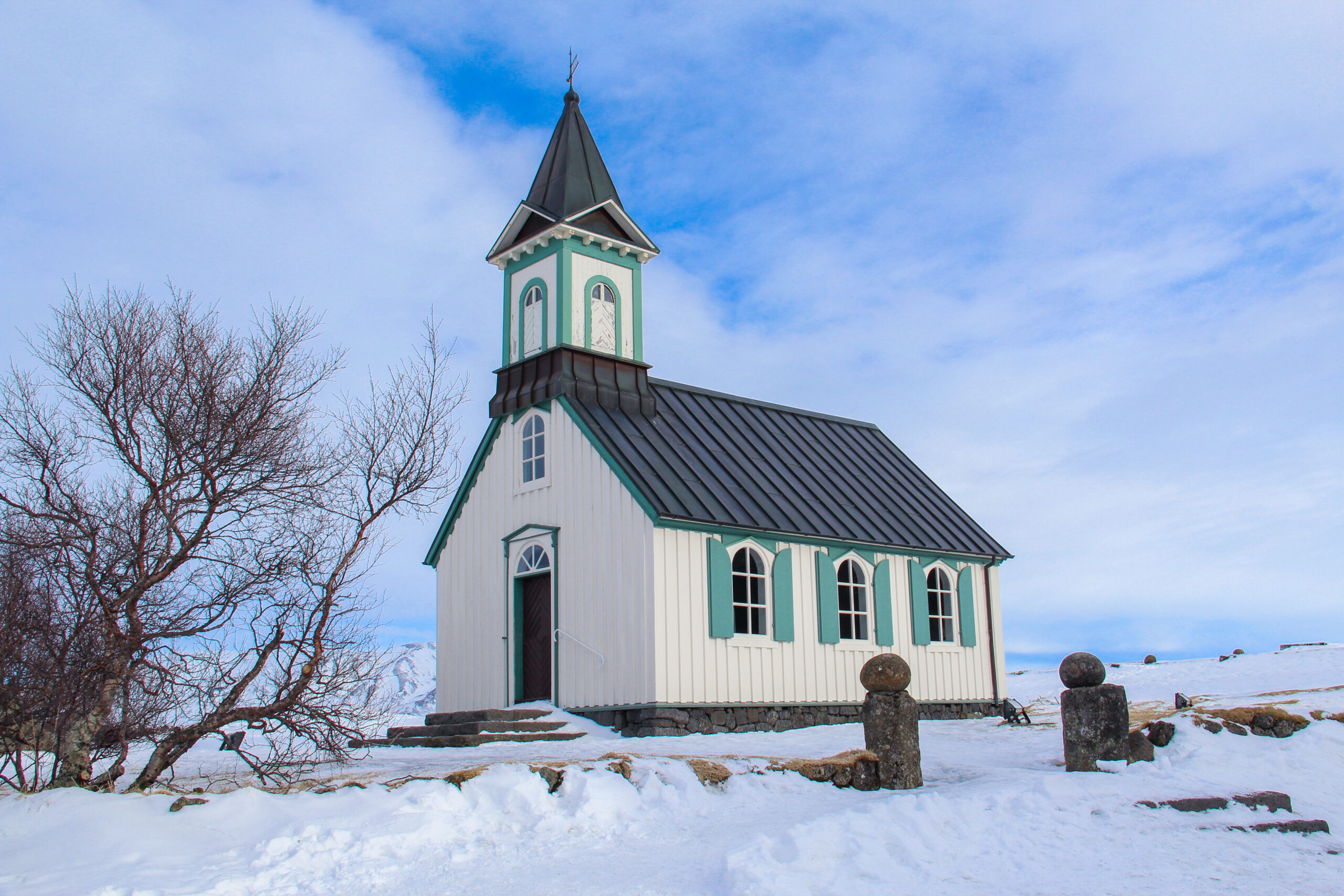
Þingvellir Church is only a few steps away from Peningagjá. Þingvellir church is originally called Þingvallakirkja and dates back to the 11th century. The church got consecrated in 1859. It is one of the most stunning small churches in Iceland.
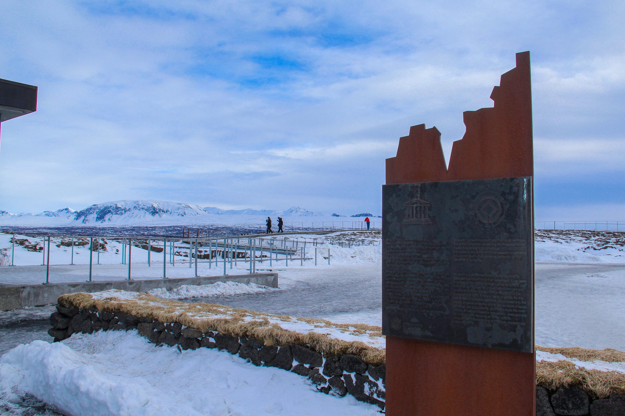
After 10 more minutes of hiking, you will reach the visitors center where you get information about the history and nature of the Þingvellir National Park. Again, you have a really stunning view over the whole National Park. It is also the place where the UNESCO World Heritage sign is located. Since 2004, the Þingvellir National Park is part of the UNESCO World Heritage sites. The sign shows the drift between the two continental plates.
On the way back to the car, you walk through Almannagjá gorge. This is a narrow valley of almost 8 km and located at the tip of the tectonic plate of North America and Europe. The two tectonical plates drift apart 3 millimeters every year.
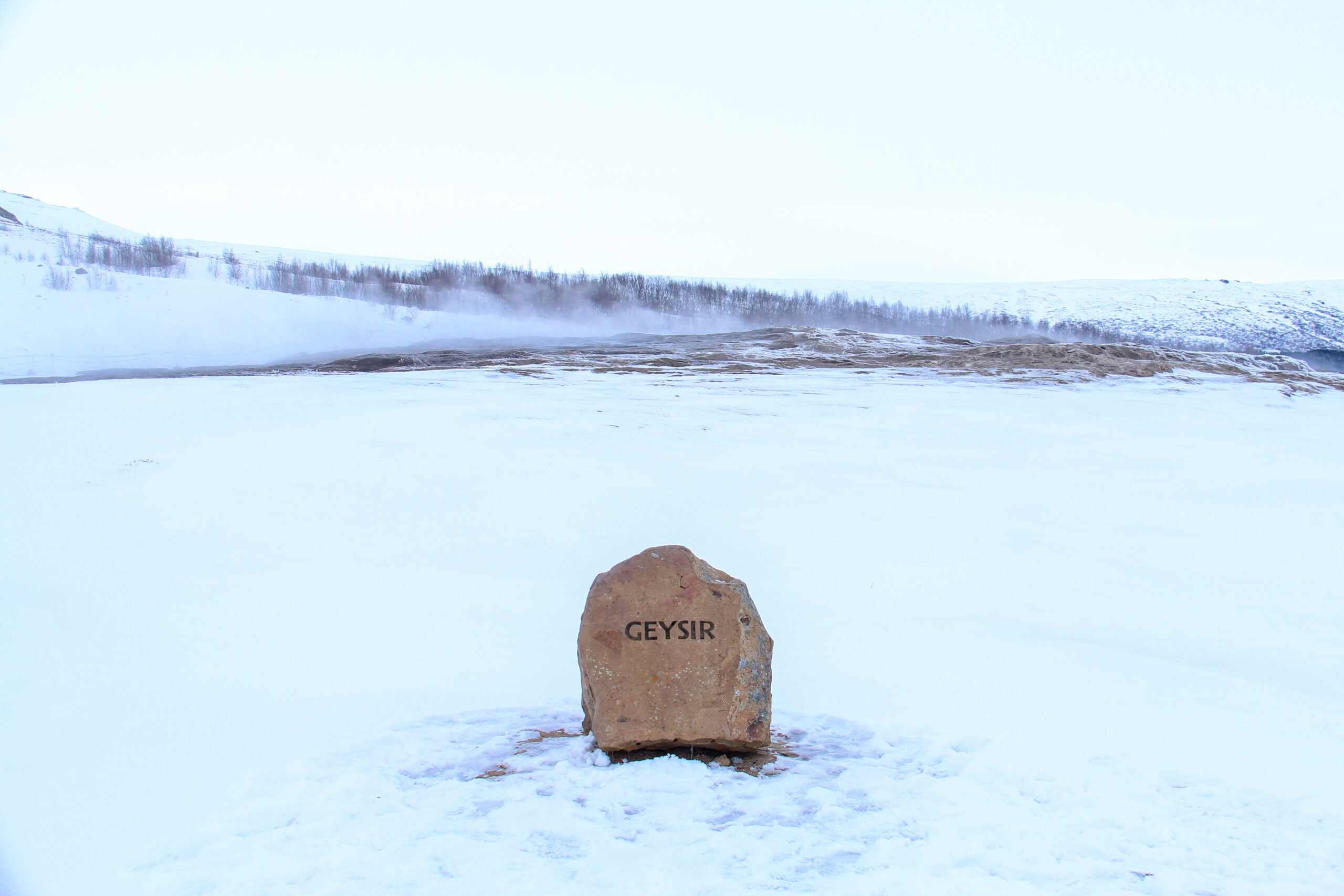
Geysir
The next stop on the Golden Circle tour is the geothermal active valley of Haukadalur. This valley was first mentioned in 1294. That year, some geysers were activated by an earthquake but others were ruined . Geysers are a very rare phenomenon and human knowledge about them is very limited. Until the 19th century, geysers were almost unknown to the Western world. The geysers in the valley of Haukadalur are one of the main tourist attractions of the Golden Circle but also of Iceland.
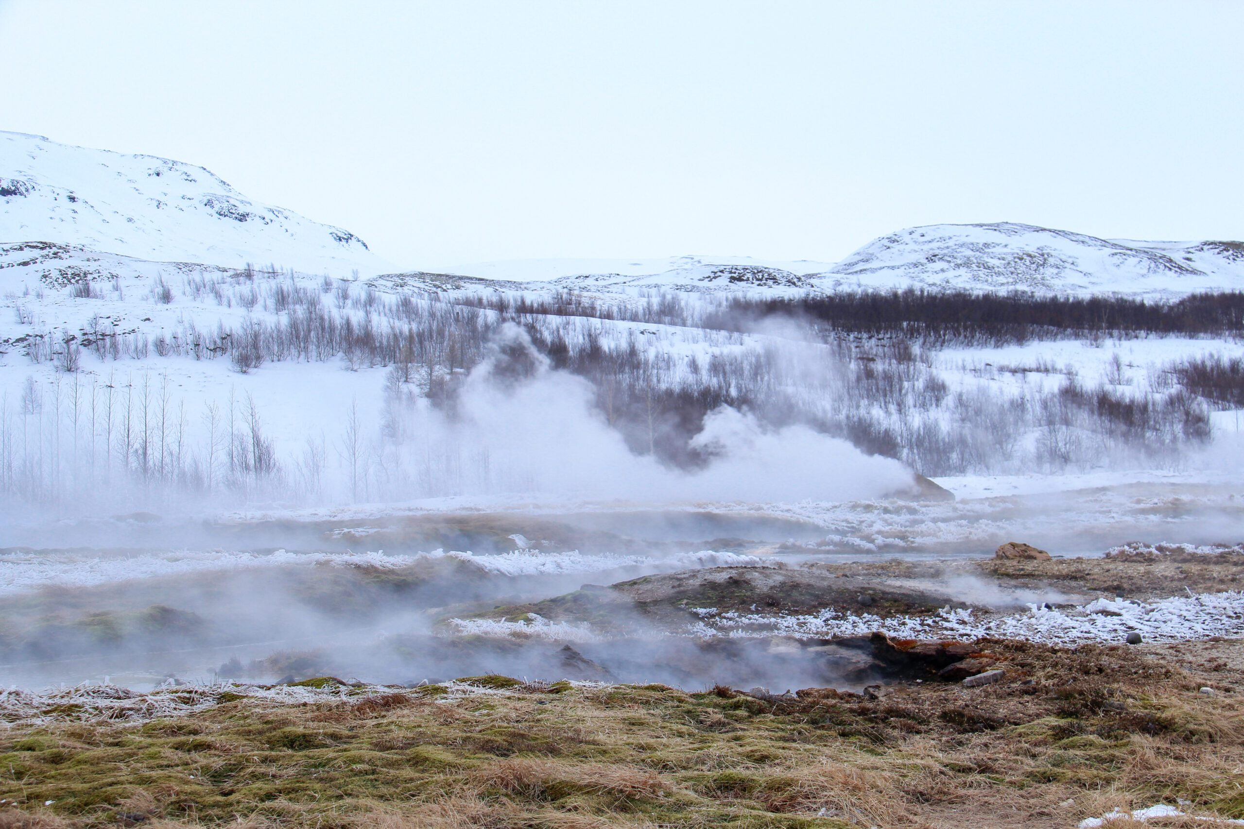
The valley of Haukadalur is mostly famous for its geysers and other geothermal features. Strokkur and the Geysir are the two main geysers in the area.
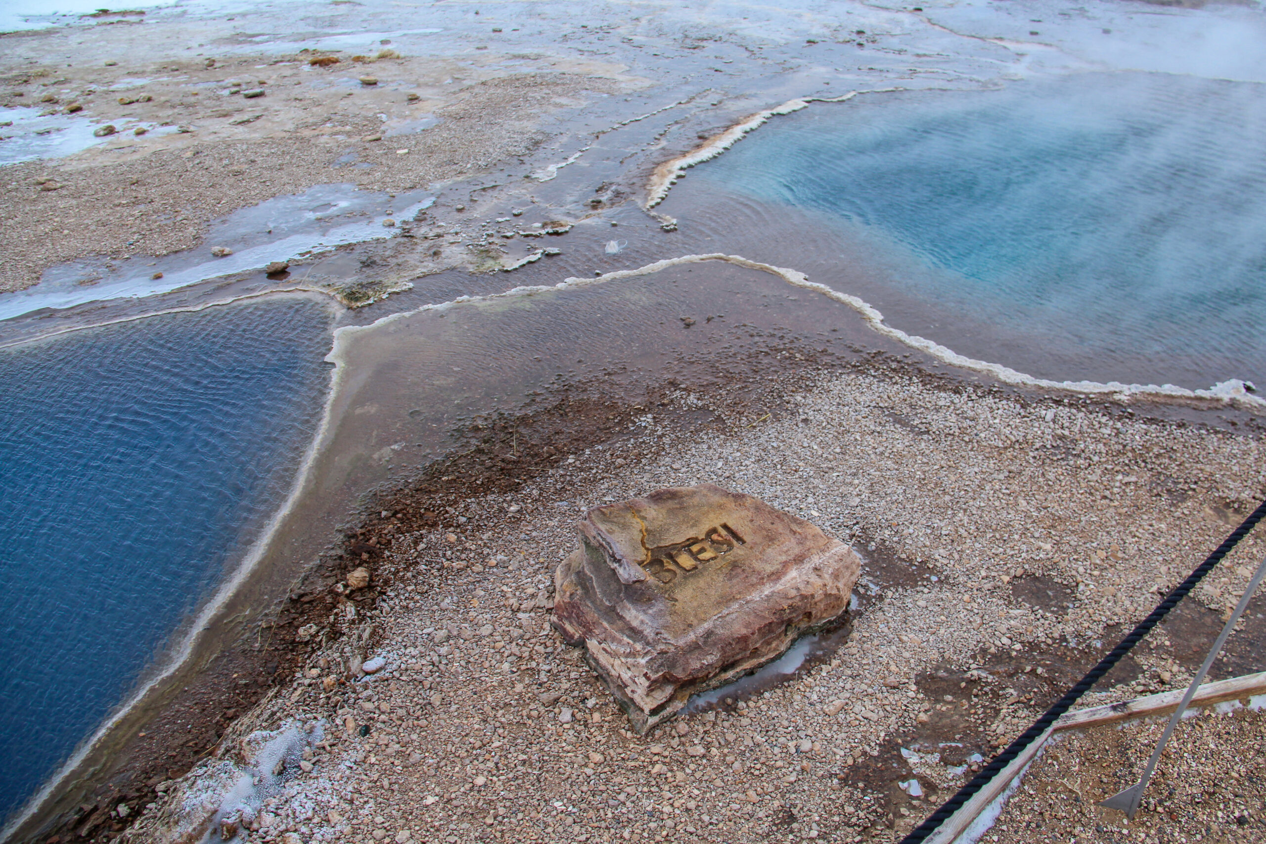
When you approach the area, you immediately smell the sulfor. The closer you get to the valley, the stronger the smell is. Just on the other side of the street, there is a huge souvenir shop with all kind of things to buy from Iceland. They sell so many things, that you almost completely forget about the geysers.
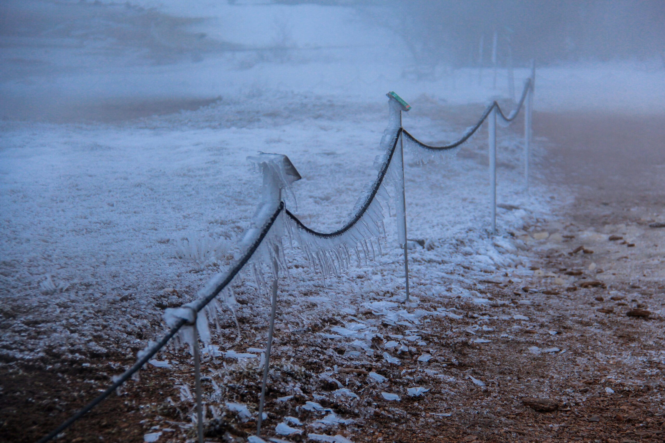
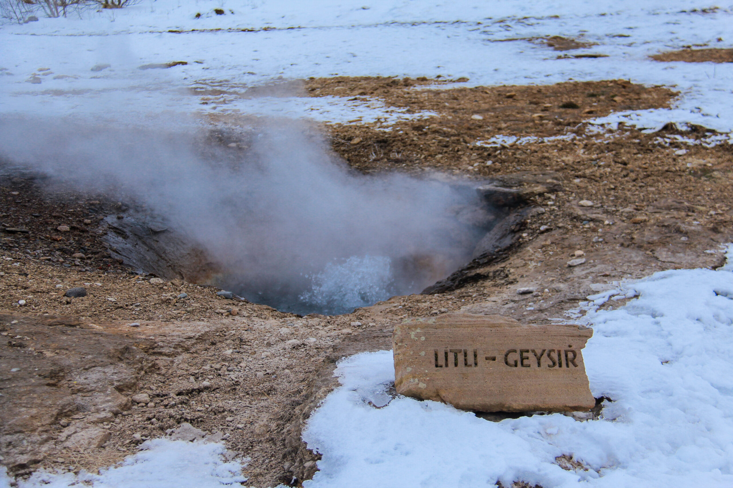
On the day we visited the geysers, it was really cold and a freezing wind. It wasn’t that cold on the thermometer, like only -1° C, but with the wind, it felt like -7° C. When you’re passing a geothermal feature, you feel the heat of it. The first geyser that you will pass it the Litli Geysir, which means little geyser.
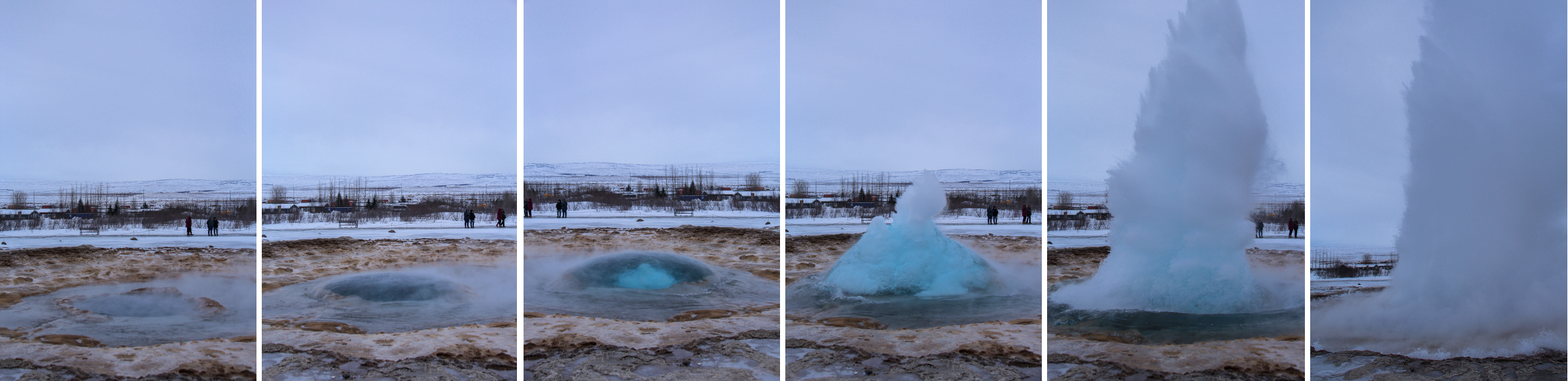
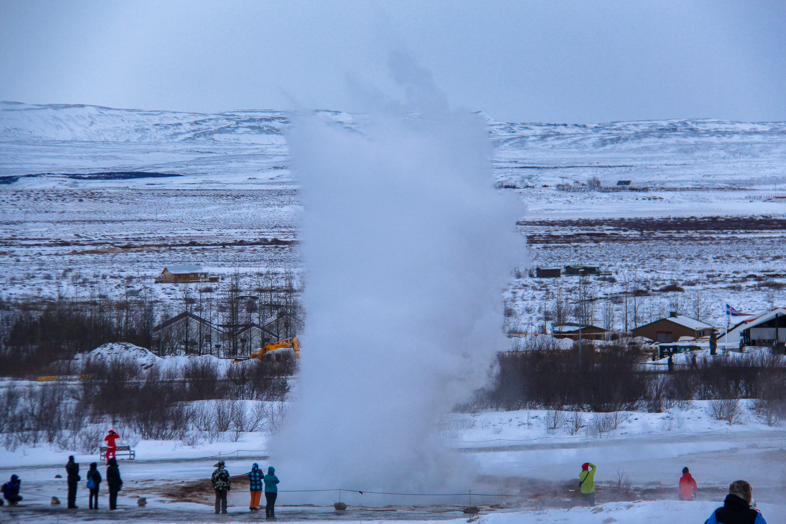
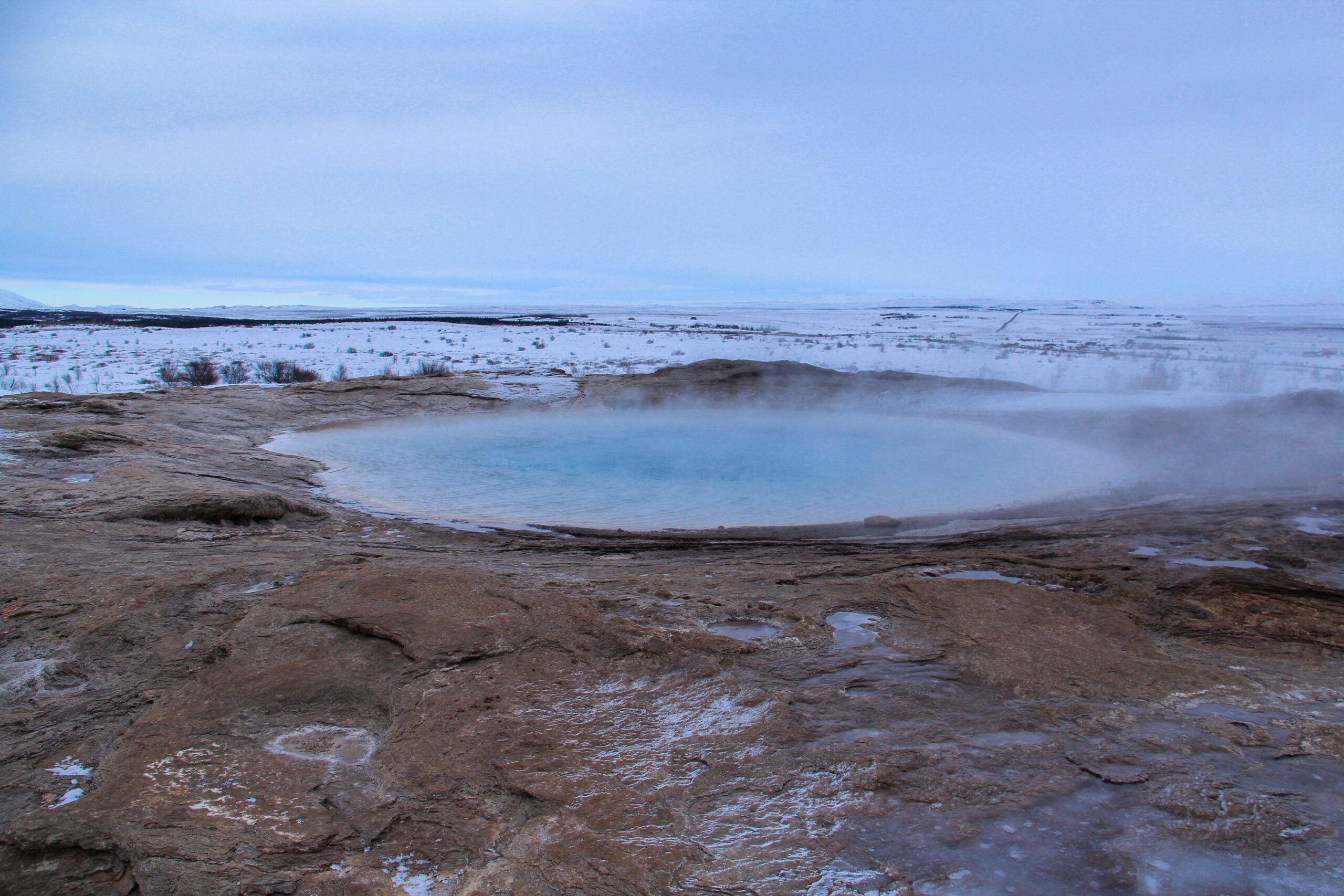
The main attraction is definitely the most active geyser Strokkur because it erupts every 4 to 10 minutes. Its height depends on the time between the eruptions. It can reach from 15 m up to 40 meters in height. Strokkur and Geysir are believed to be the same age. As the Geysir was more impressive, Strokkur wasn’t mentioned until 1789.
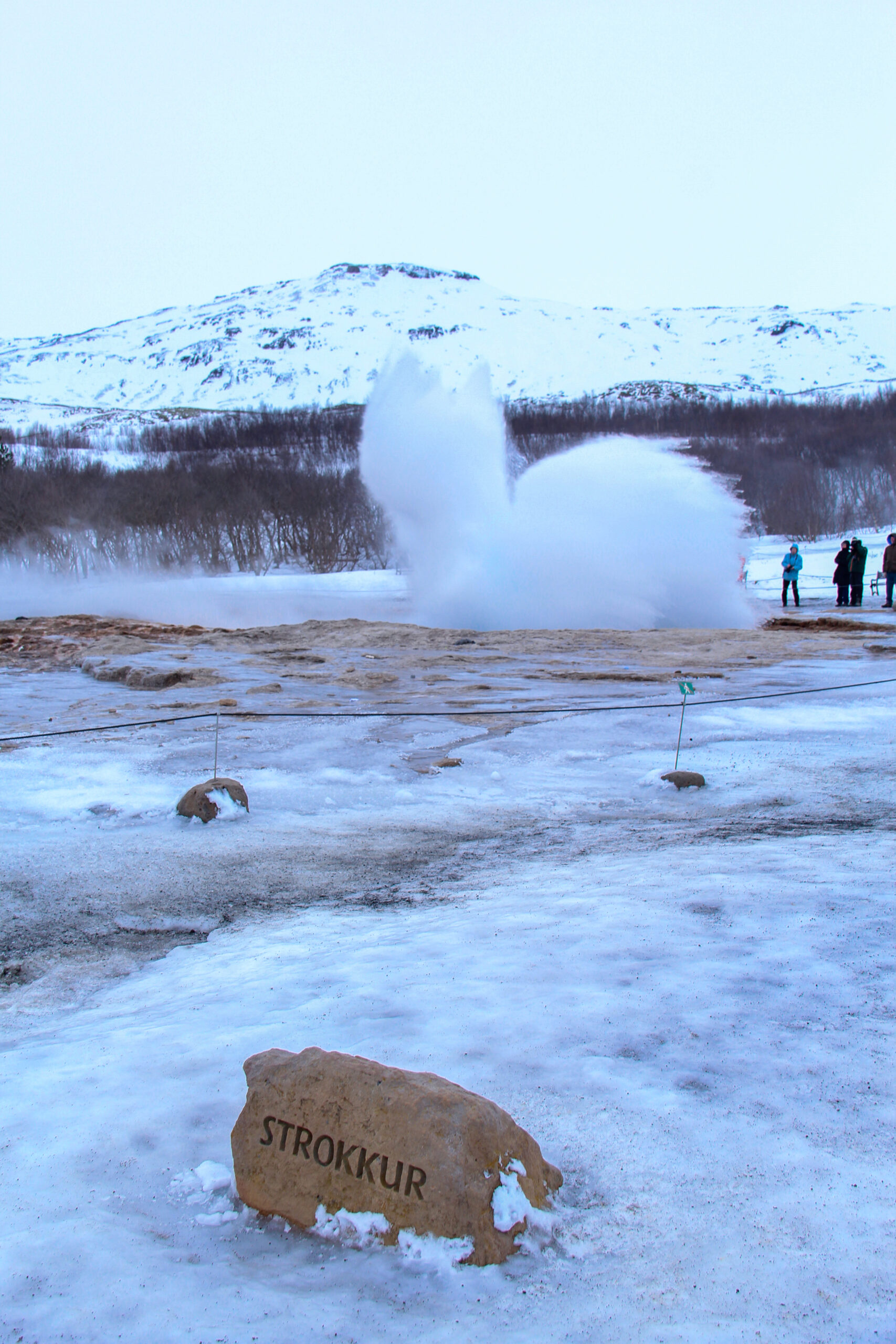
In 1789, an earthquake unblocked the conduit of Strokkur and so it continued to erupt until the change of the 20th century when another earthquake blocked the conduit. Until 1963, it didn’t erupt anymore. Thanks to the locals, who cleaned out the blocked conduit, we are lucky today to experience the eruption of Strokkur every 4 to 10 minutes.
The other geyser, the Geysir or Great Geysir, is the one who gave the name geyser to every other geyser. It is the first known geyser to modern Europeans. The word geyser derives from the name Geysir. It is proven, that it was active for over 10.000 years. In history, it was blocked several times and continued then after an earthquake. But since 2003, the Great Geysir has stopped erupting.
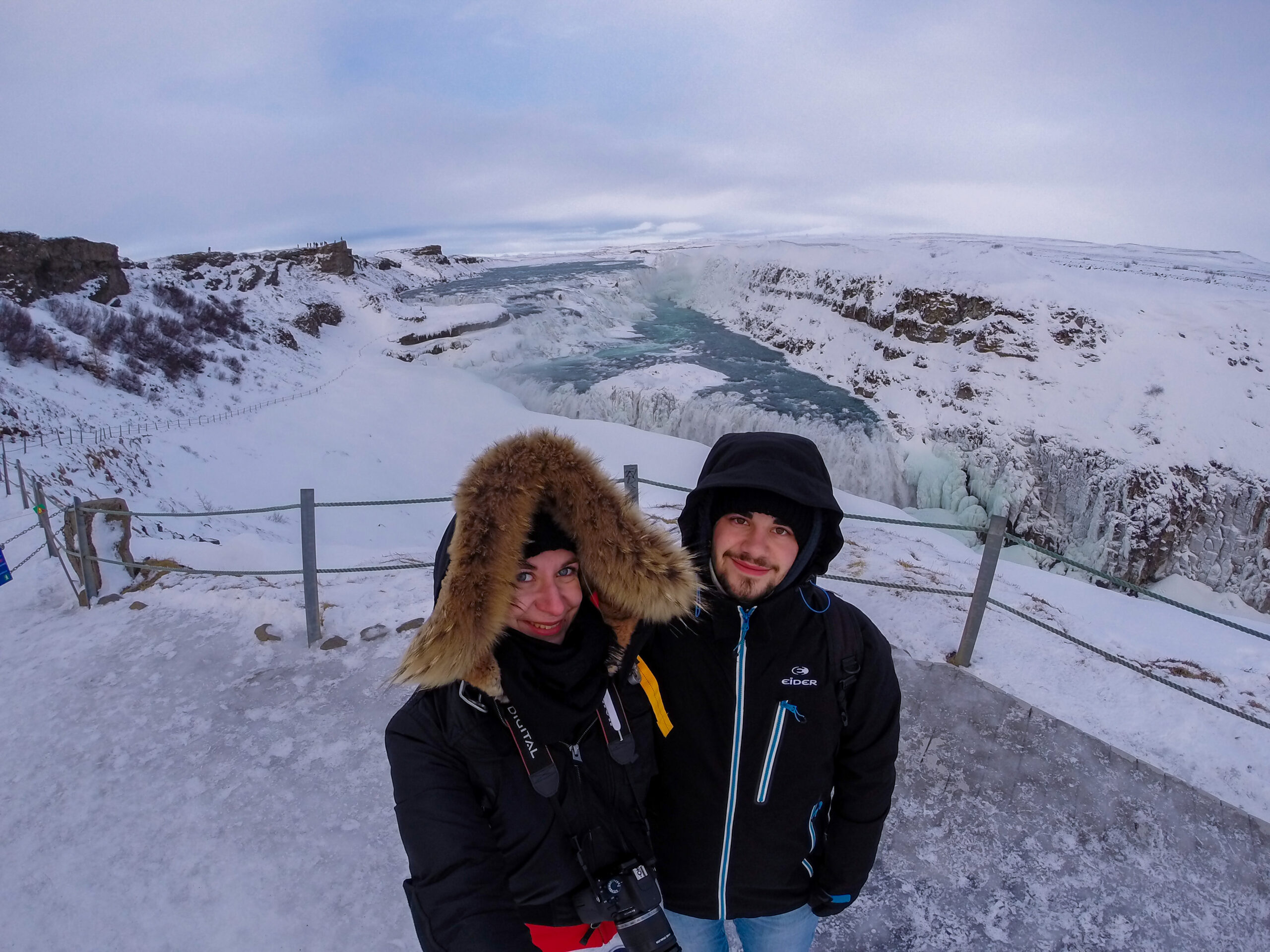
Gullfoss
Gullfoss is a waterfall in the southwest of Iceland. The name Gullfoss means Golden Waterfall. It is the largest waterfall in Europe and its water is fed by the second biggest glacier in Iceland, the Langjökull. The waterfall plummets down in two stages in a canyon, which reaches ip to 70 m in height. Gullfoss is considered as being one of the top 10 waterfalls in the world.
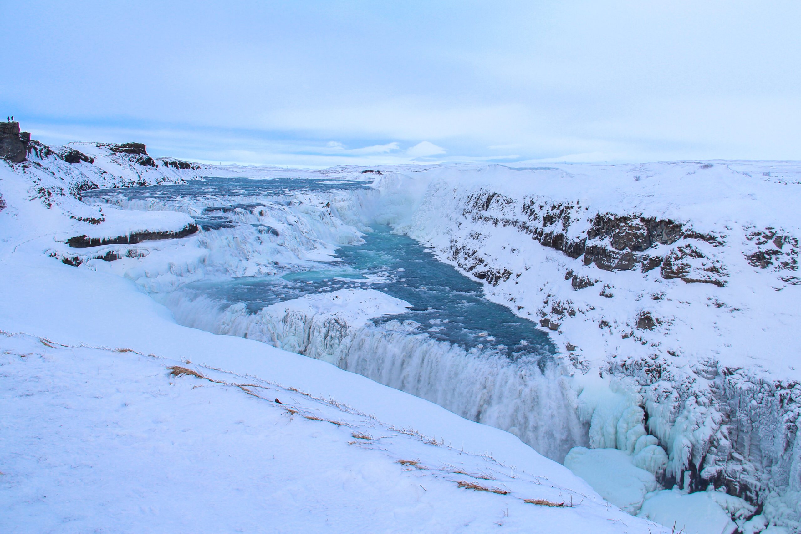
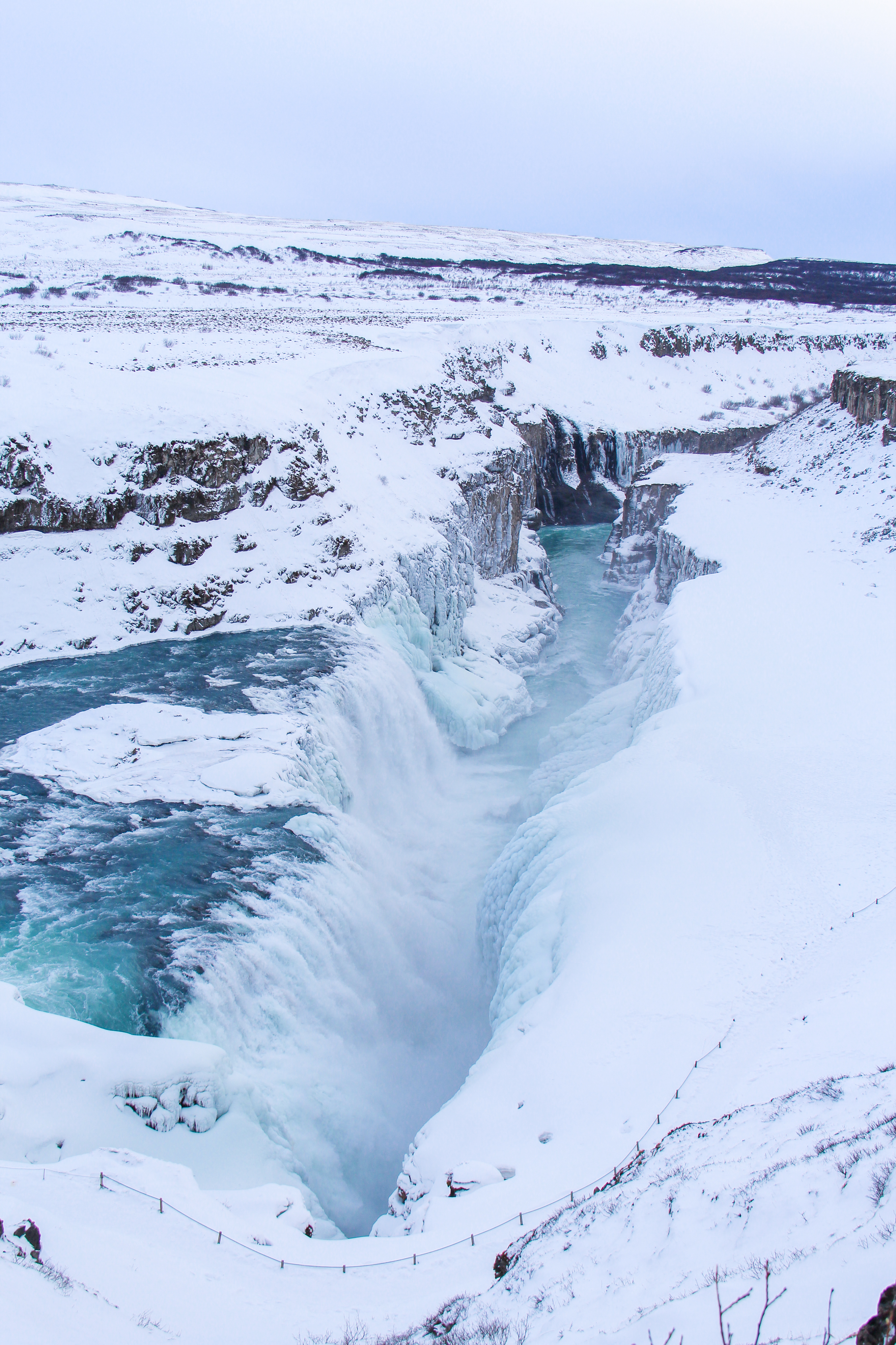
The Gullfoss is really stunning. When you’re standing in front of it, it’s really amazing and kind of magical. In winter, everything is covered with snow and ice, and makes it even more magical. When you’re visiting it in summer, you can even see rainbows when the sun is shining.
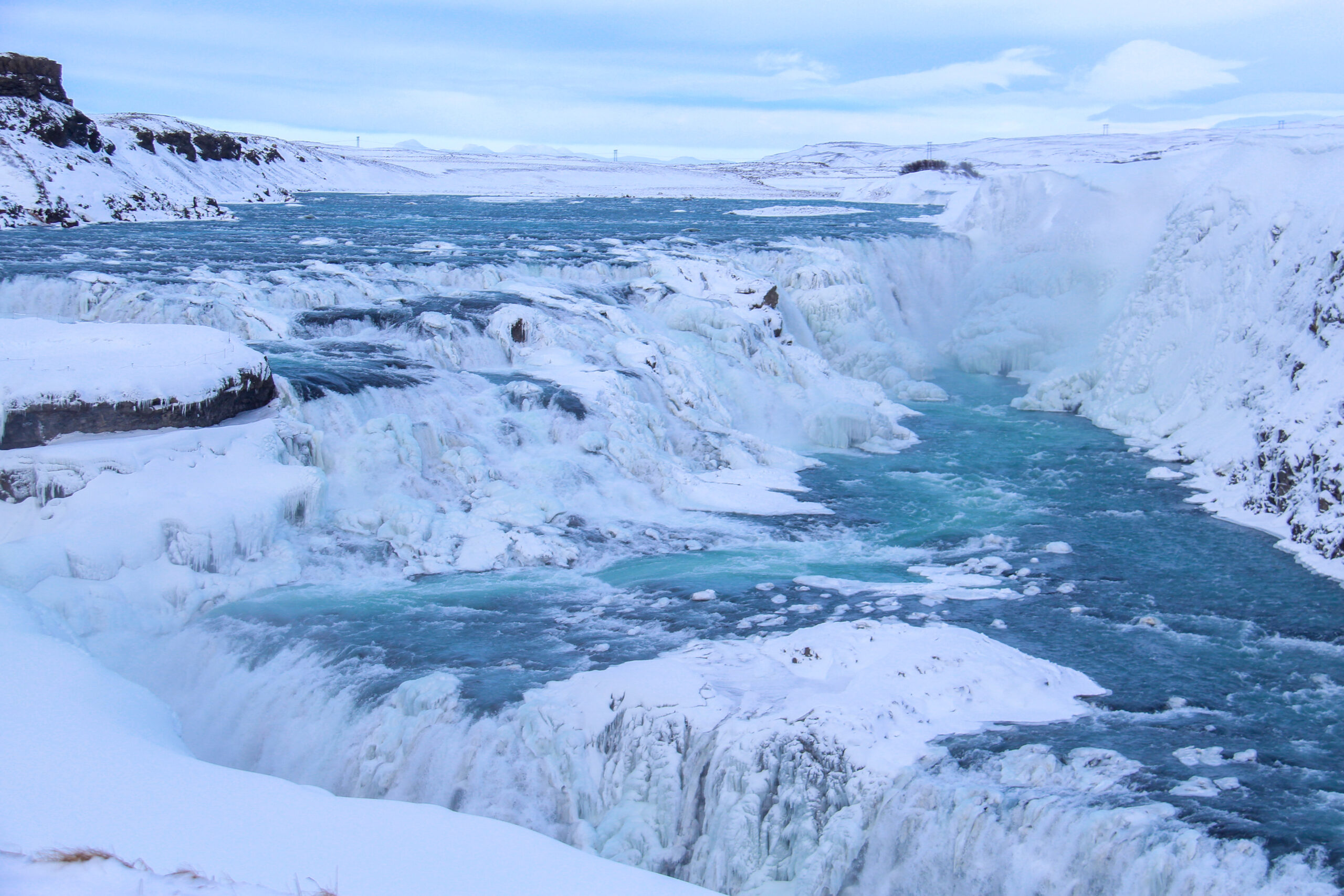
There are two different decks to observe Gullfoss. On the one hand, you can see it from the top, and on the other hand from the middle of the waterfall. In summer, you can walk very close to the waterfall, but in winter that is too dangerous, so this path was closed.
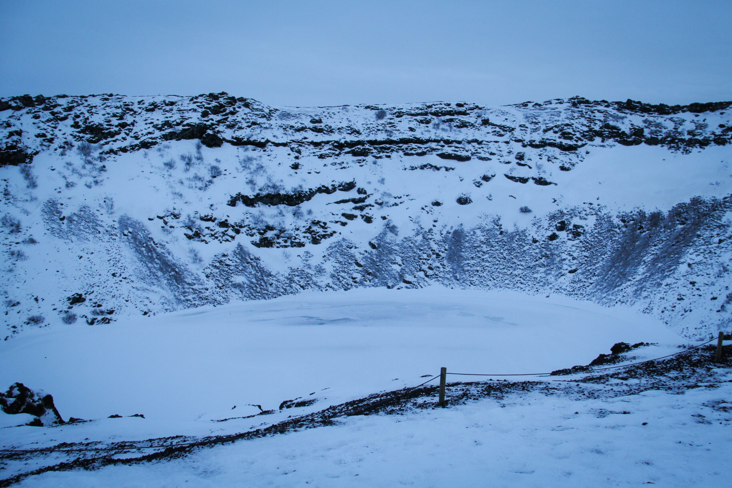
Kerið
Kerið is a volcanic crater lake. It was a cone volcano, which erupted and emptied its magma reserve. It is one of the most visually stunning geological wonders in Iceland. This blue crater is about 6,500 years old. This makes is one of the three most recognizable volcanic craters in Iceland.
Unfortunately, you don’t see the blue of the water in the crater in winter. Everything is covered with snow. But it is still very impressive to be so close to a volcano.
Have you already been to Iceland and did you do the Golden Circle?
Read next: Via Ferreta on Mount Norquay in Banff National Park Canada
Wow, the photos are just so amazing! I really enjoyed reading this post. What an unforgettable experience this must have been.
http://www.LUXESSED.com
thank you 🙂 it was absolutely amazing! You should put it on your bucket list!